


Photos from the road: Canyonlands NP and Arches NP
Part 1 of 2 from a road trip through Canyonlands, Arches, and Rocky Mountain National Park

We’re back from another week on the road, and I couldn’t be more ready to print again.
Meghan and I hopped in the Jeep with plans to ultimately make it to Denver, CO via Rocky Mountain National Park. We had plans to meet up with my sister at a Morgan Wallen concert, but how we got there was up to us and the road.
Naturally, we took 9 days on back highways and dirt roads to cross through Canyonlands, Arches, and Rocky Mountain National Parks. These are the trips that refill my cup the most: no real plans, some camping gear, a couple of cameras, an atlas and a long list of National Parks that we still haven’t visited. I always come back with a sketchbook full of ideas and a newfound joy for the slower side of life.
These photos capture how I want to remember these awe-inspiring landscapes and moments. Most are taken with my easy shooting mirrorless camera—a Nikon Zfc with a 28mm prime lens, so I get to have some fun with wider angles and aggressive feature cropping.
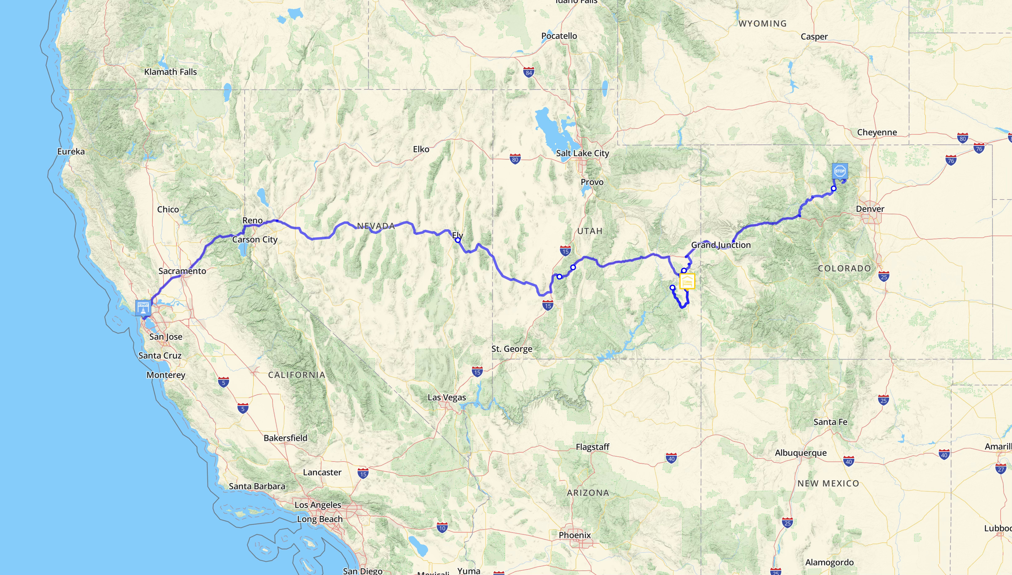
Our route
When time permits, Meghan and I opt for the back roads. Interstates aren’t made for memories. So we pick a destination and start driving while Meghan uses our atlas to keep adjusting our route into a generally right direction.
There was something magical about following the Colorado River from Canyonlands—which was carved out of the earth by the same river that formed the Grand Canyon—all the way back to its headlands in Rocky Mountain National Park.
The full route we took this time ended up being:
San Francisco, CA → Reno, NV
Reno → Ely, NV via hwy 50 (the self proclaimed “Loneliest Road in America”)*
Ely → Beaver, UT via hwy 21, the Wah Wah Mountains, and Sevier Lake
Beaver → Canyonlands NP via I-70 and Moab, UT
Canyonlands NP → Arches NP via… the entrance? they’re just on either side of Moab from each other
Arches NP → Grand Junction, CO via hwy 128
Grand Junction → Grand Lake, CO / Rocky Mountain NP via hwy 131 and Trough Road**
Our only rule was to follow the Colorado river from Canyonlands to the Rockies. So every chance we got to hop off of a highway and follow the dirt, we took it. There was something magical about following the Colorado River from Canyonlands—which was carved out of the earth by the same river that formed the Grand Canyon—all the way back to its headlands in Rocky Mountain National Park. And if you’re counting at home, that means we hit 3 of the 5 national parks within the Colorado River basin in this one trip.
*The Loneliest Road in America is one of my favorite roads in America. It’s 287 miles of pure, southern Nevada desert. You’re actually driving across the original Great Basin and end up passing Great Basin National Park on the eastern end of the highway. Every night that I’ve passed through, I could see the Milky Way clear as day. Life Magazine once warned that motorists would need “survival skills” to make it through this high desert… It’s incredible.
**Trough Road is a dirt road with a website. It’s GPS guided off-roading. It’s 24 miles of following the Colorado River gorge up and over mountains and through gravel filled hairpin turns. I guarantee half of the pickup trucks we passed with their windows down and fishing poles in the back were also rocking a road beer just out of sight. If you ever get the chance, it’s worth the trip.
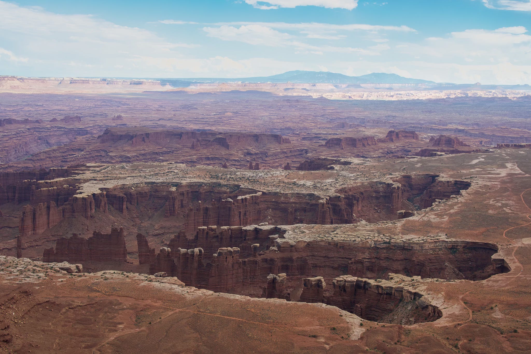
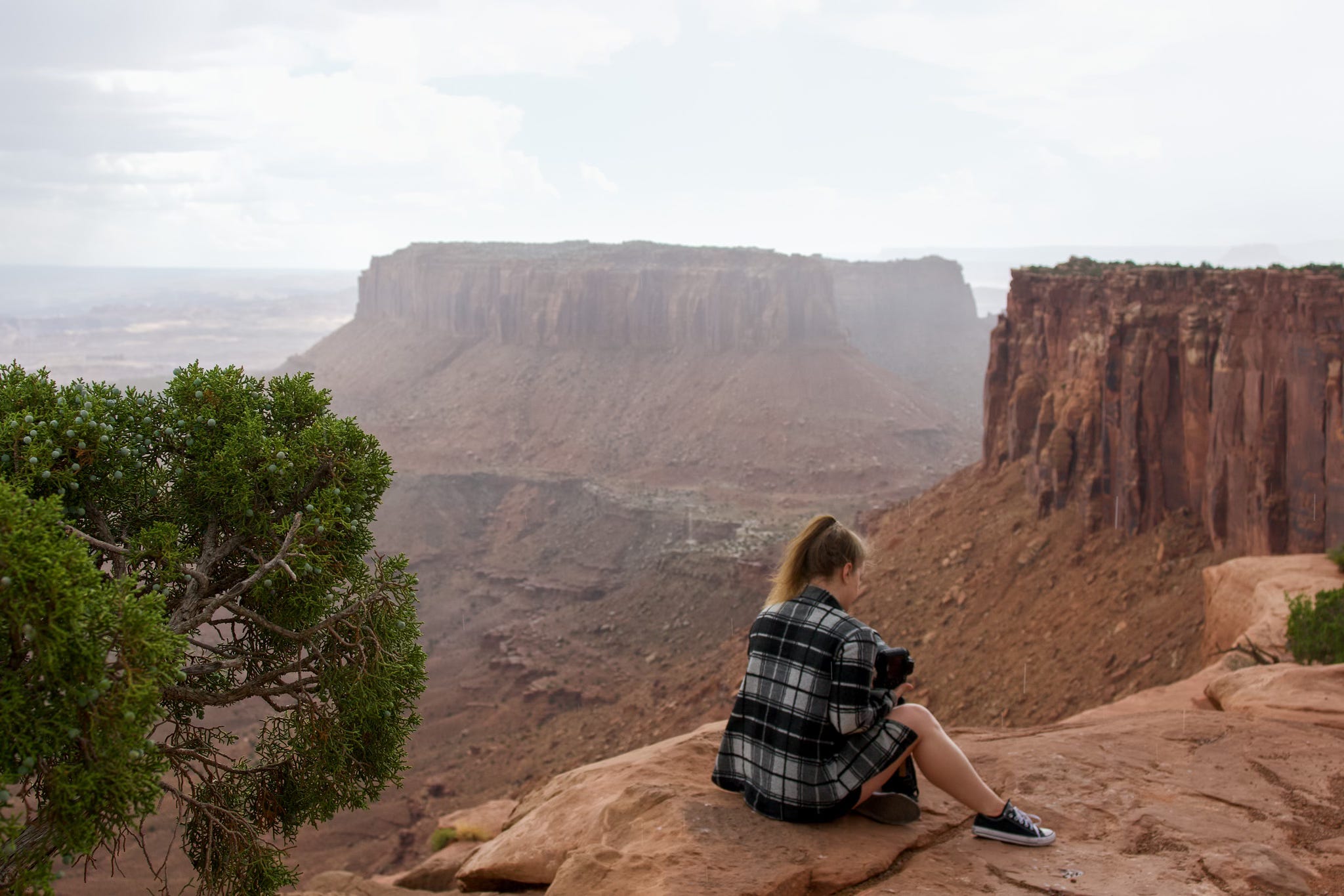
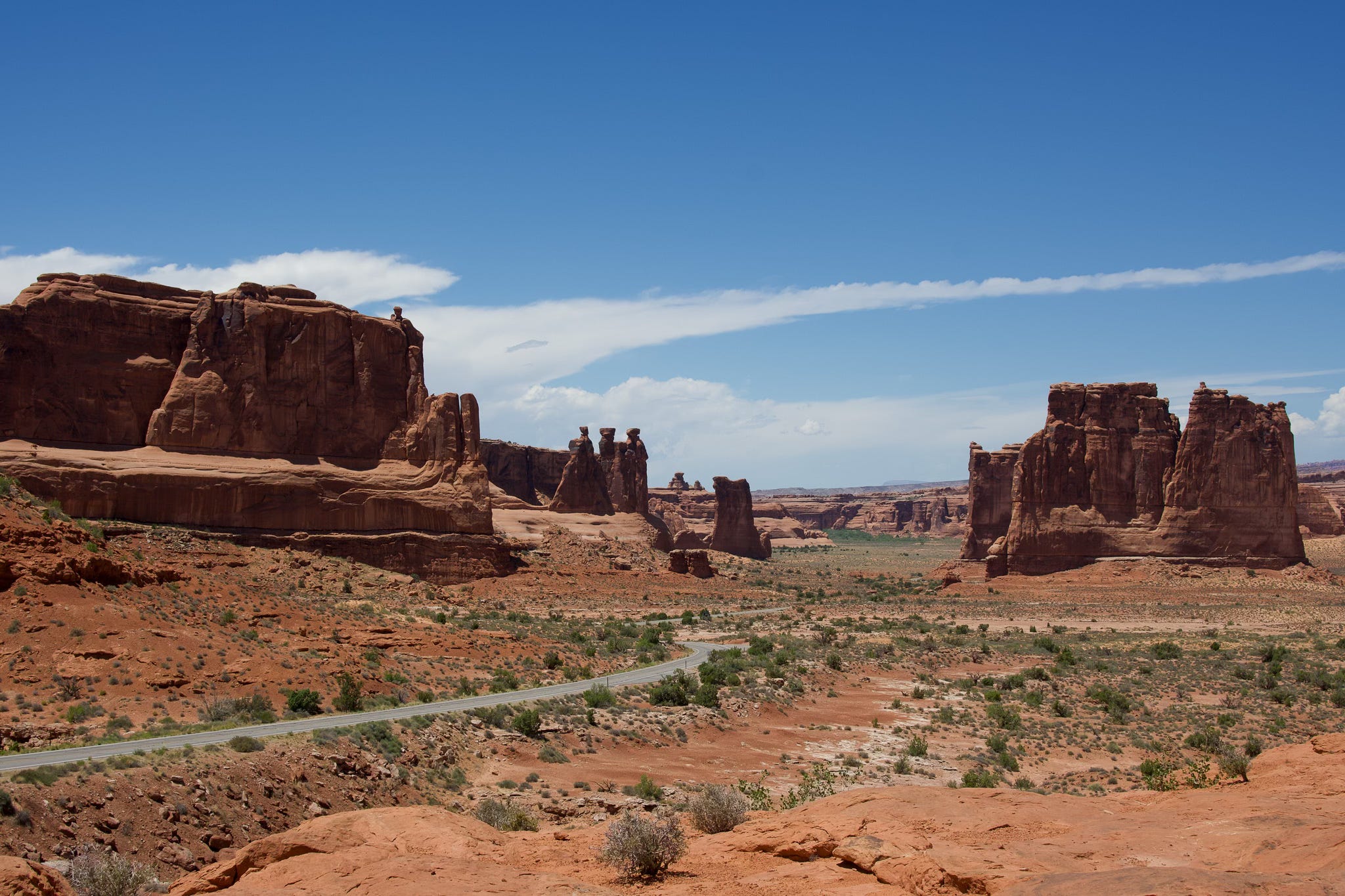
Canyonlands National Park
Island in the Sky, North Entrance
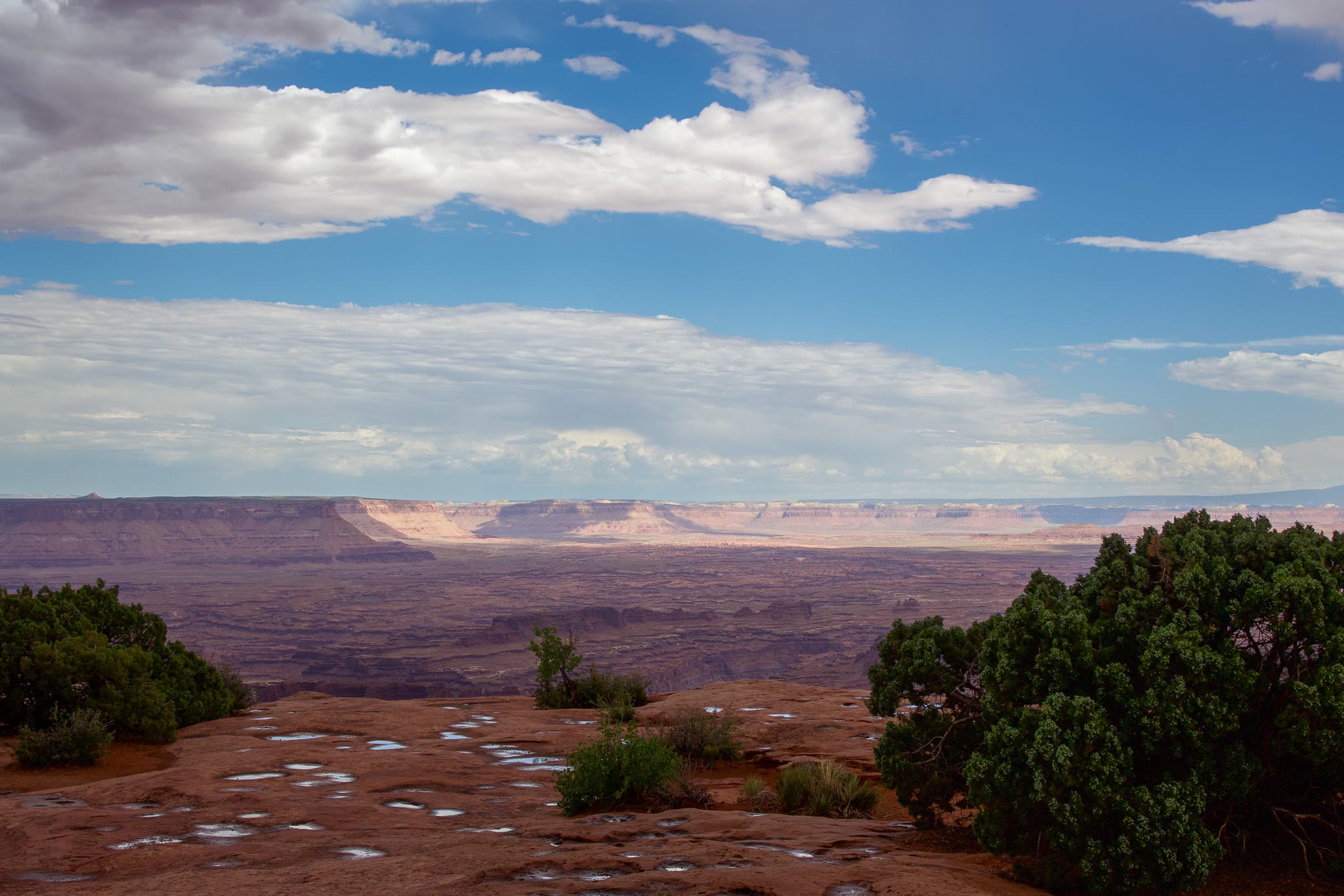
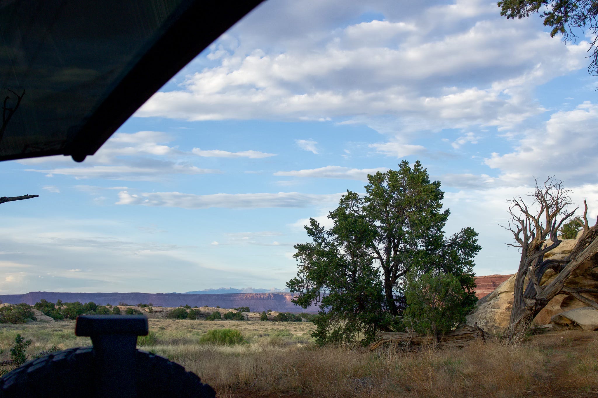
We entered Canyonlands via Island in the Sky. This place is a perfectly named marvel of the earth. We were quite confused by looking at the map as to why it would take us several hours to drive out to our destination and back to the highway to get to the south entrance—but once you’re out overlooking the canyons, you realize that you are teetering on a knife’s edge of a peninsula that sits above three distinct layers of cliff edges.
Immediately, this became one of my top five parks.
The Needles, South Entrance
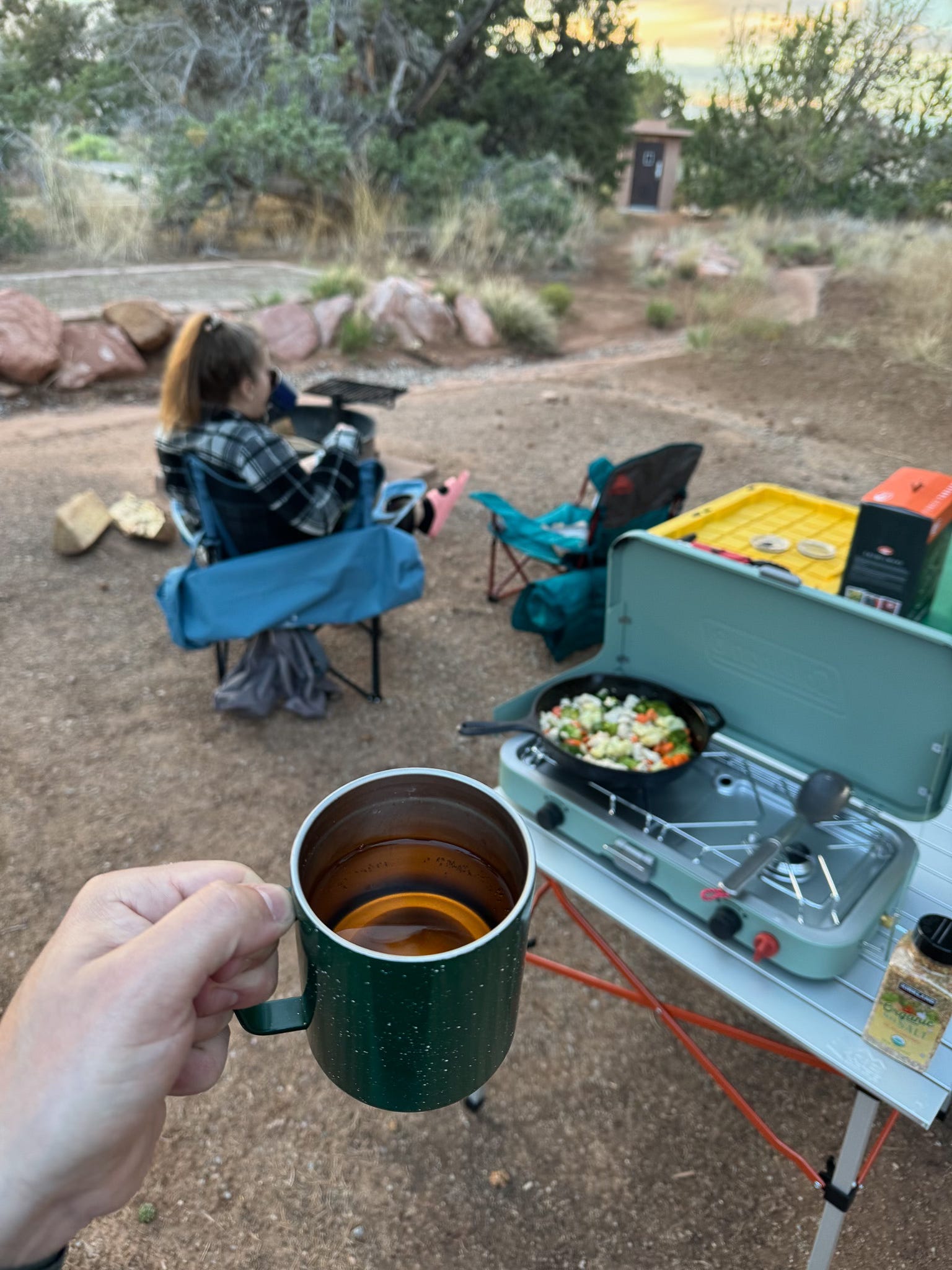
Our plan for the night was a camping reservation for the night in The Needles Campground.
Now, if you happen to be planning your trip with an atlas in your lap and no phone signal, you might see that the distance from Island in the Sky to The Needles is only about 12 miles as the crow flies. What you might not realize as the sun starts to set and you have to find your way to this campsite is that that 12 miles as the crow flies is actually 122 miles of driving around the entire eastern side of the canyon and back into the base of the canyon that you were just taking beautiful photos of.
It’s also much smarter to make that drive with more than a half tank of gas…
Don’t worry, we made it to camp with plenty of daylight. We made a stir fry and drank chilled orange wine thanks to a friend who stocked us up before we left (thanks Mario). This now goes down as my favorite National Park campsite.

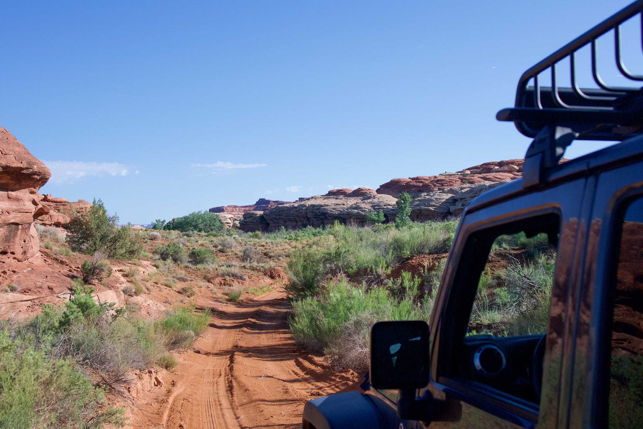
We couldn’t leave the canyon without hitting a trail—after all, Canyonlands is one of the US’ premier four wheel drive, off-roading spots in the US. So we took a 6 mile detour out on Colorado River Overlook road and got a bit of dust thrown up the side of the Jeep so that we fit in a little better in Moab.
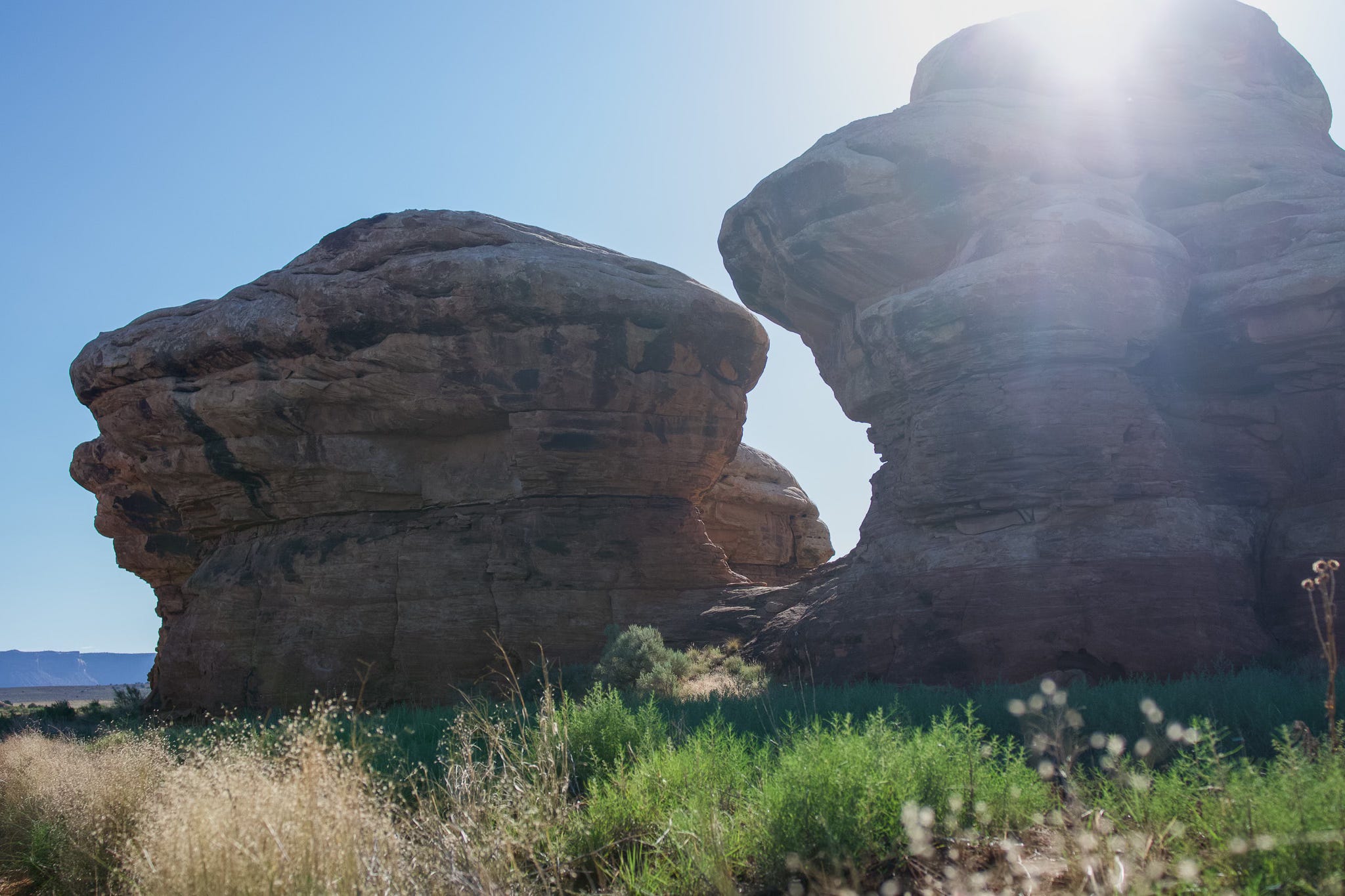
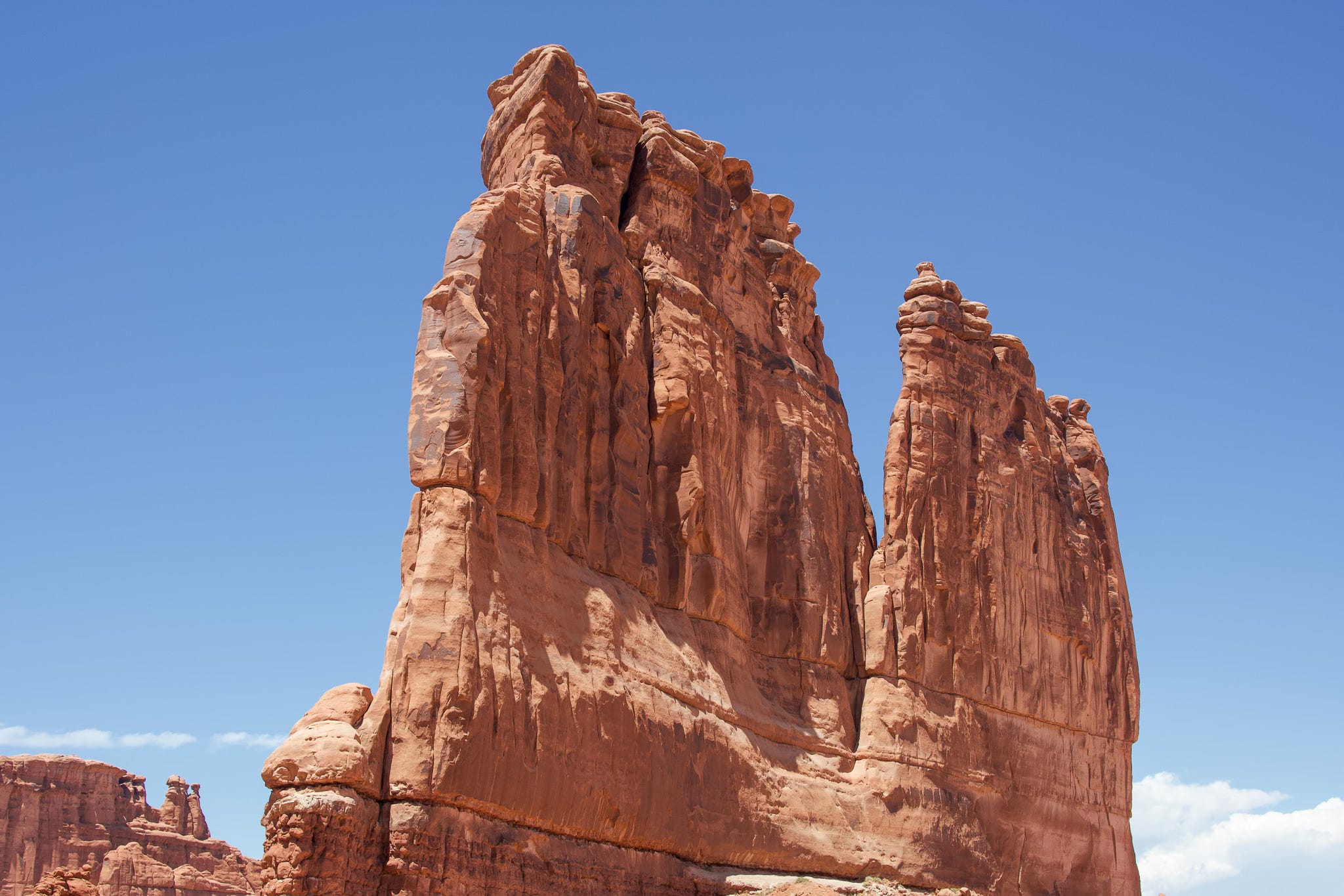
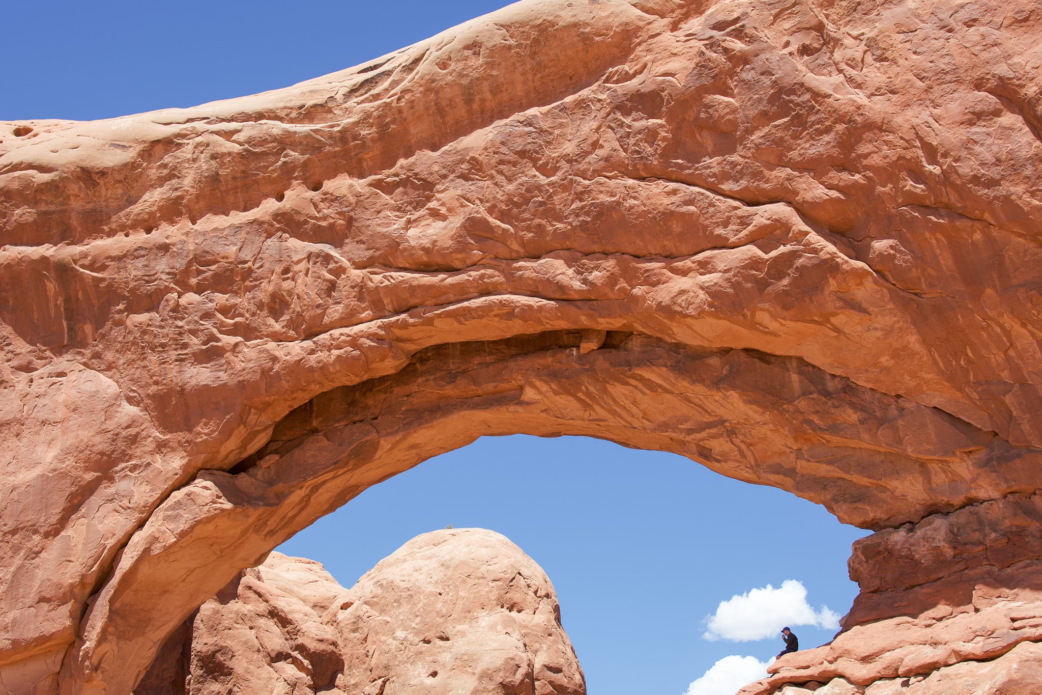
Arches National Park
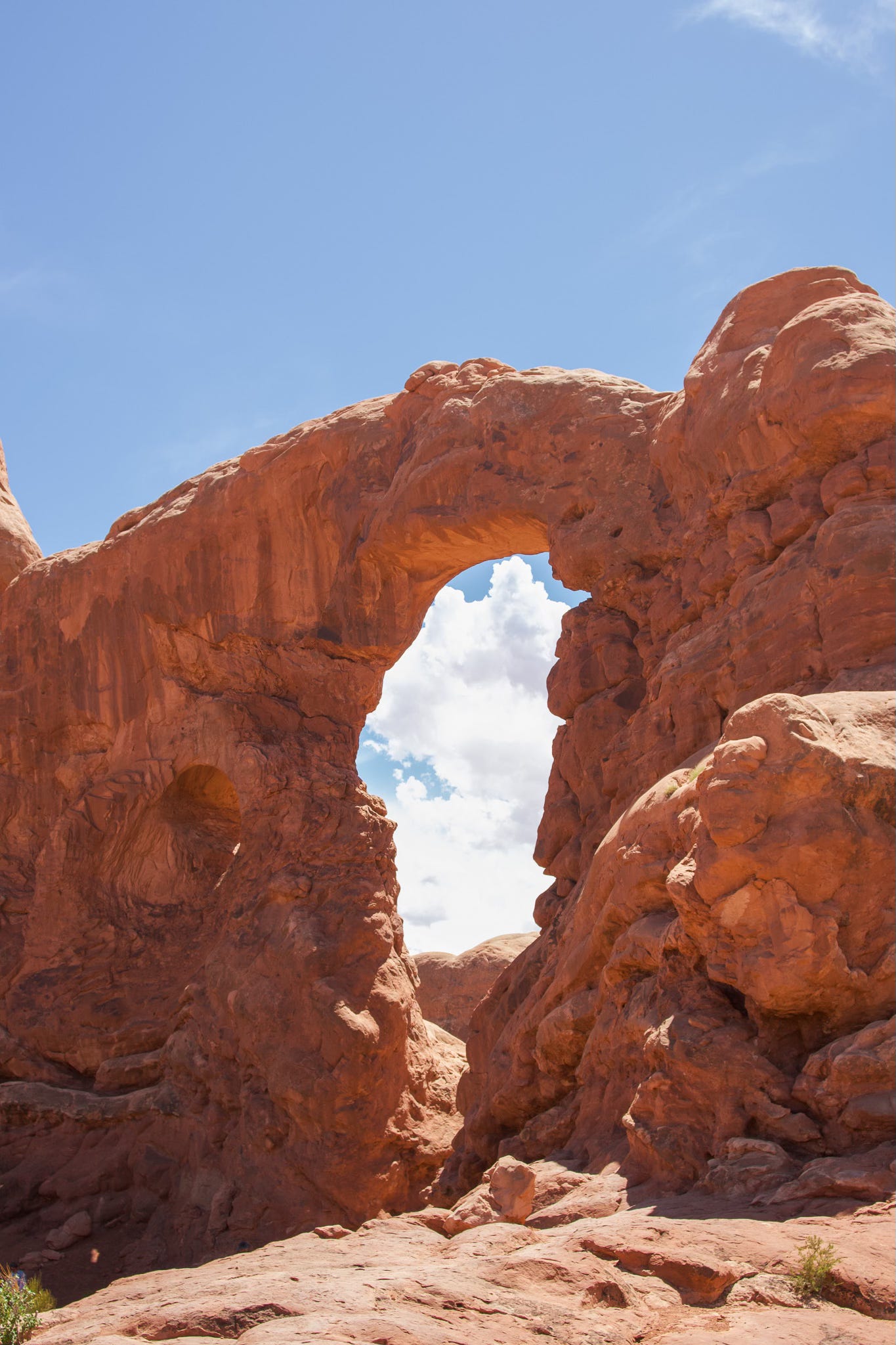
Arches is just… hard to describe.
It’s much smaller, but still significantly more famous, than Canyonlands. The two are next door neighbors—quite literally across the road from each other—but couldn’t be further from each other in ecological features. The plants are different, the stone is different, the methods in which the major features are carved are different. And it’s funny, because if you stand at some of the higher points in Arches and look back to the south west, you can see the canyon.
Visiting the two in the same trip is a really cool peek into desert ecology and geology.
It was 101°F while we were visiting Arches. Signs up and down the trails cautioned hikers from exploring while it’s over 90°F in the park, so we took it a bit easier than usual. And quite frankly, these are the moments I don’t like to admit how Meghan’s penchant for safety is often the only thing still keeping me alive. I did drink one whole liter of water! (Meghan had 4)
We hit The Windows Trail and the Double Arch trail so that we could see the big stuff and not succumb to heat stroke.

Part 2 is on its way. Look out for the next post with photos from Rocky Mountain National Park, a surprise winery along the way, and another bonus look at my nerdy side (this time, not rocks!).
Thanks for reading. Stick around for more stories from the road. A print inspired by this trip is in the works, so be on the lookout!
See you again soon 🏔️